HI TARGET RTK GPS V90 PLUS GNSS RTK SYSTEM
Model No.︰V90 Plus
Brand Name︰Hi Target
Country of Origin︰China
Unit Price︰-
Minimum Order︰1 pc
Product Description
V90 PLUS GNSS RTK SYSTEM

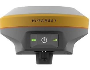
With a hi-tech, fully integrated design, the conveniently sized V90Plus is one of the most flexible choices for any measuring task. Built-in Linux3.2.0 operating system, pre-loaded multiple smart applications such as tilt surveying, electronic bubble calibration, NFC and voice DIY, V90Plus GNSS system provides surveyor industry-leading GNSS solutions.
Features :
Small and lightweight
· Only weighs 950g.
· Measures Diameter 153mm x Height 83mm.
Multi-constellation Tracking
· 220 tracking channels
· Supports GPS, GLONASS, GALILEO, BDS, SBAS
· NGS approved full-band GNSS antenna
Smart Application
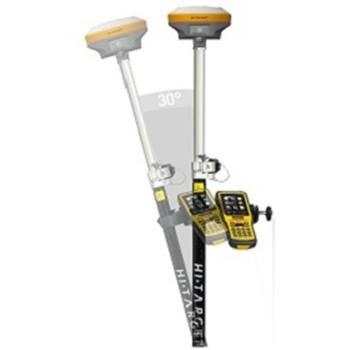
· Offers tilt survey with a maximum tilt angle of 30 degrees.
· Supports electronic bubble calibration
· The internal NFC module makes Bluetooth communication quick and easy.
· Intelligent voice assistance guides field operations. Voice can be DIY.
· Standard Rinex data and HI-TARGET raw data recorded simultaneously.
Optional Transceiver UHF Radio
· The transceiver UHF radio enables switchable working modes between base and rover.
· Three types of internal UHF radio provide different frequencies based on users requirements. The Pacific Crest TrimTalk© internal UHF radio is compatible with other radios.
Multi-network Connection
· Supports GPRS, GSM and WCDMA
· Supports WIFI
Powerful Battery
· Powered by high-capacity (5000mAh) Li-ion battery to ensure full day operation
Rugged Design
· IP67 dustproof and waterproof
· Able to survive a 3-meter natural fall onto concrete
Parameter :
Satellite Signals Tracked Simultaneously
220 Channels
GPS……….. Simultaneous L1C/A, L2C, L2E, L5
GLONASS……………..Simultaneous L1C/A, L1P, L2C/A (GLONASS M only), L2P
SBAS……………………. Simultaneous L1 C/A, L5
Galileo………………... Simultaneous L1 BOC, E5A, E5B, E5AltBOC
BDS………………..…….……………………………. B1, B2
QZSS…………………….. L1 C/A, L1 SAIF, L2C, L5
POSITIONING PERFORMANCE
Static and Fast Static GNSS Surveying
Horizontal……………………2.5mm+0.5ppm RMS
Vertical…………………………. 5mm+0.5ppm RMS
Post Processing Kinematic (PPK / Stop & Go) GNSS Surveying
Horizontal……………………….. 1cm+1ppm RMS
Vertical………………………… 2.5cm+1ppm RMS
Initialization time……….Typically 10 minutes for base while 5 minutes for rover
Initialization reliability……Typically > 99.9%
Real Time Kinematic (RTK) Surveying
Single Baseline
Horizontal……………………….. 8mm+1ppm RMS
Vertical…………………………. 15mm+1ppm RMS
Network RTK
Horizontal……………………….. 8mm+0.5ppm RMS
Vertical………………………….. 15mm+0.5ppm RMS
Initialization time……..…Typically < 8seconds
Initialization reliability…….Typically > 99.9%
Code Differential GNSS Positioning
Horizontal………………………. 25cm+1ppm RMS
Vertical…………………………… 50cm+1ppm RMS
SBAS ……… 0.50m Horizontal, 0.85m Vertical
HARDWARE
Physical
Dimensions (W x H)…….153mm x 83mm (6.02inch x 3.27inch)
Weight………950g (2.09lb) without internal battery
Operating temperature………. -40℃to +65℃ (-40℉ to +149℉)
Storage temperature…………. -40℃ to +75℃(-40℉ to +167℉)
Humidity………………………. 100%, considering
Water/dustproof……………….. IP67 dustproof, protected from temporary immersion to depth of 1m (3.28ft).
Shock and vibration……………Designed to survive a 3m(9.84ft) natural fall onto concrete.
Payment Terms︰ TT/Western Union
Product Image


